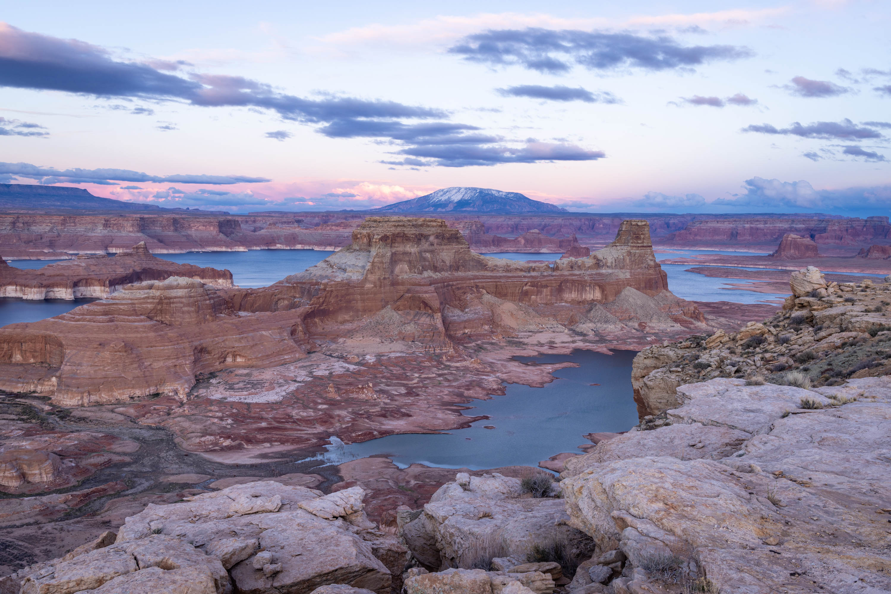
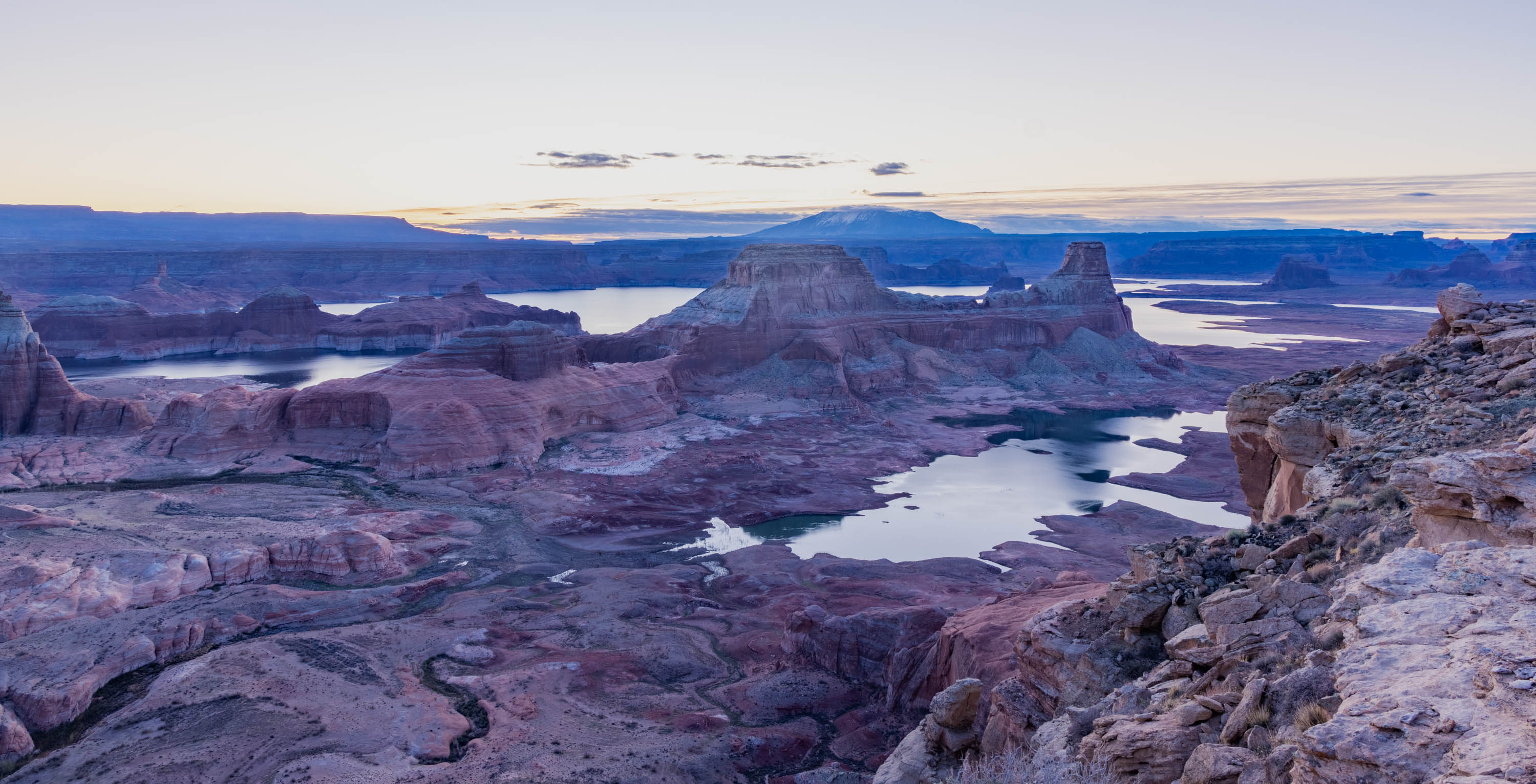
Alstom Point is one of those stunningly beautiful overlooks that is hard to get to, but in the end, worth the journey. The point lies just past Page, AZ across the border of Utah, along a 40 mile dirt road that turns treacherous, rock crawling, and hard to navigate.
Sunset overlooking Lake Powell
The view at the end of the journey is it’s reward, with sprawling vantage points of Lake Powell and Gunsight Butte. The Lake was significantly low, at only 31% of full (or 141 feet below full), but offered new canyons, waterways, and ridges to gawk at from high above.
Our first camping trip of the year was only for an unfortunate short period of time, but the view while it lasted was memorable.
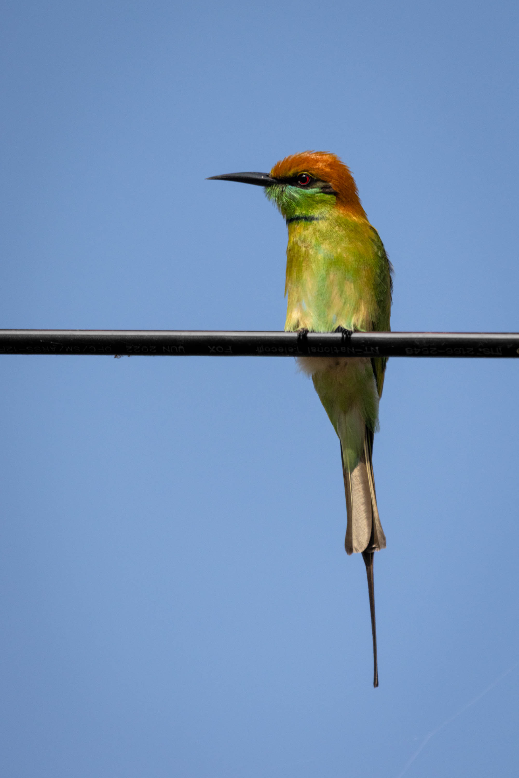
Thailand is full of a myriad of flora and fauna, interesting flowers, and colorful birds. Our guide, Pip Pip, was good enough (and patient enough) to teach us many different varieties.
Little Green Bee EaterWhite throated King fisherIndo-Chinese Roller
As many birds as we saw, we only got a decent photographs of a few. Many were beautiful but just too far away, like the oriental honey buzzard, Asian open bill stork, and coppersmith barbet.
But we did manage to see Oriental Pie hornbill, such an interesting bird, and Orange breasted trogan.
Orange breasted troganOriental Pie HornbillHornbill
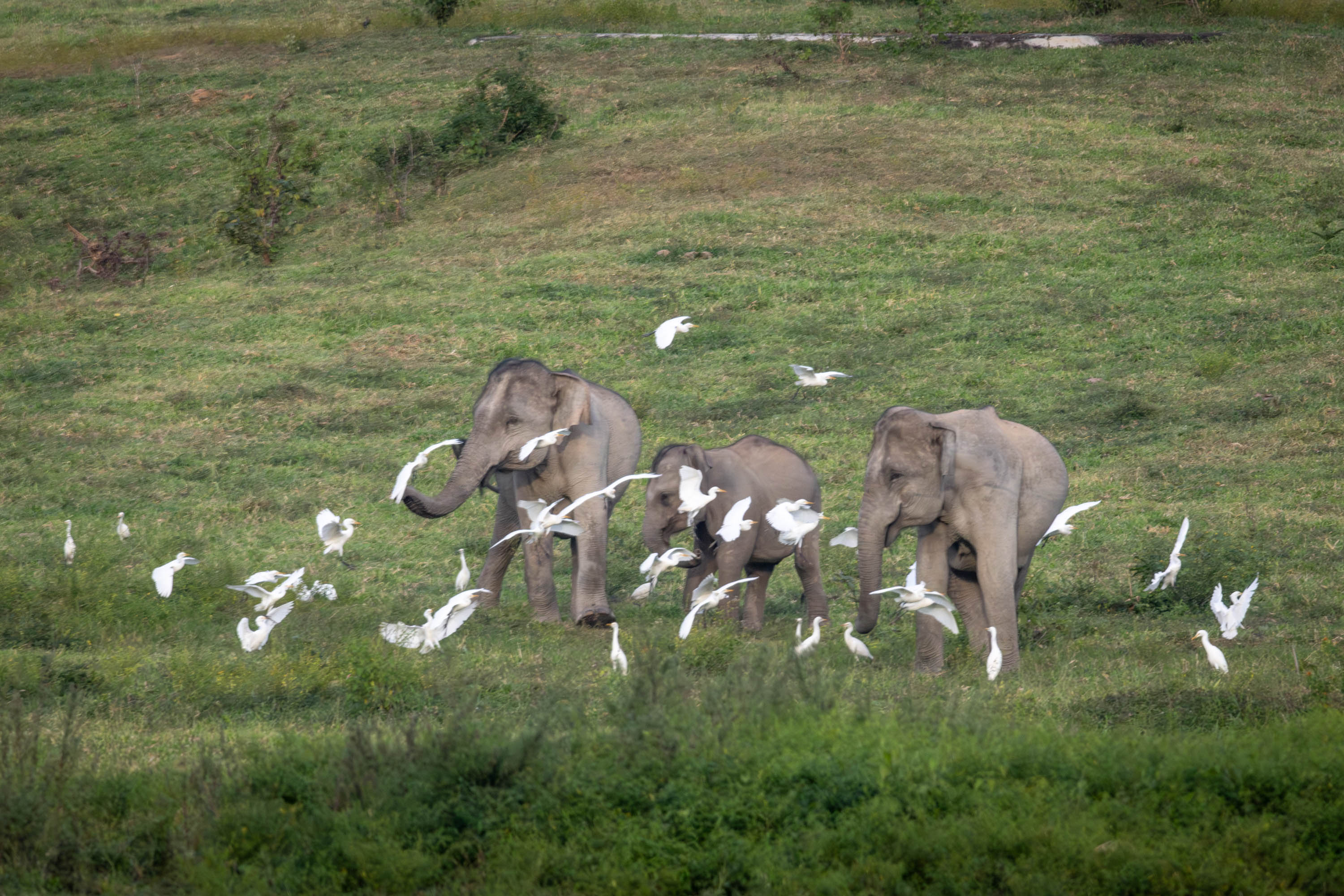
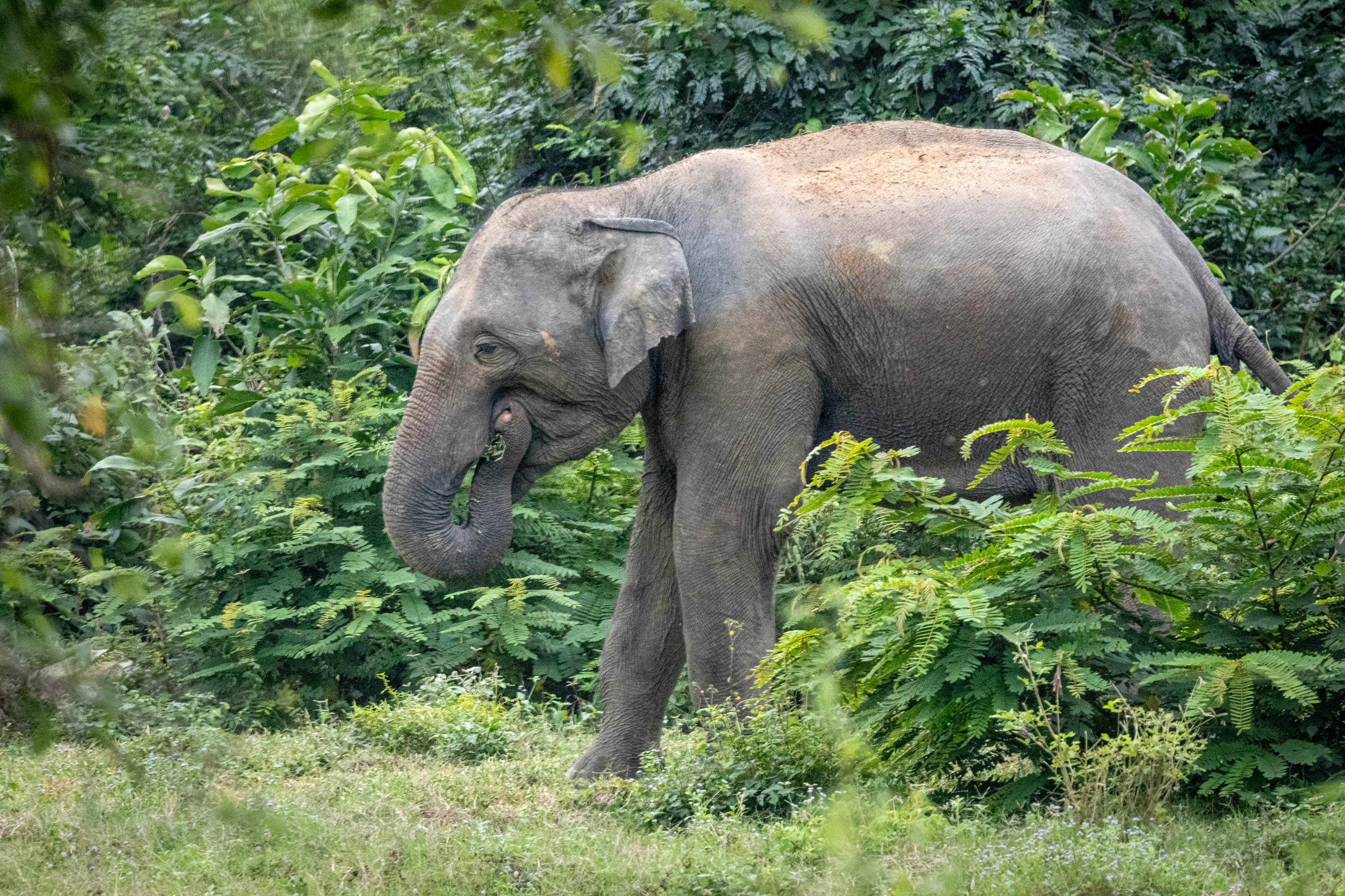
As much as I enjoyed the wide variety of amazing birds, I was really thrilled to see and photographically capture large mammals, like elephants, not in captivity, but in the wild, and Asian sun bear.
Asian elephantAsian sun bear
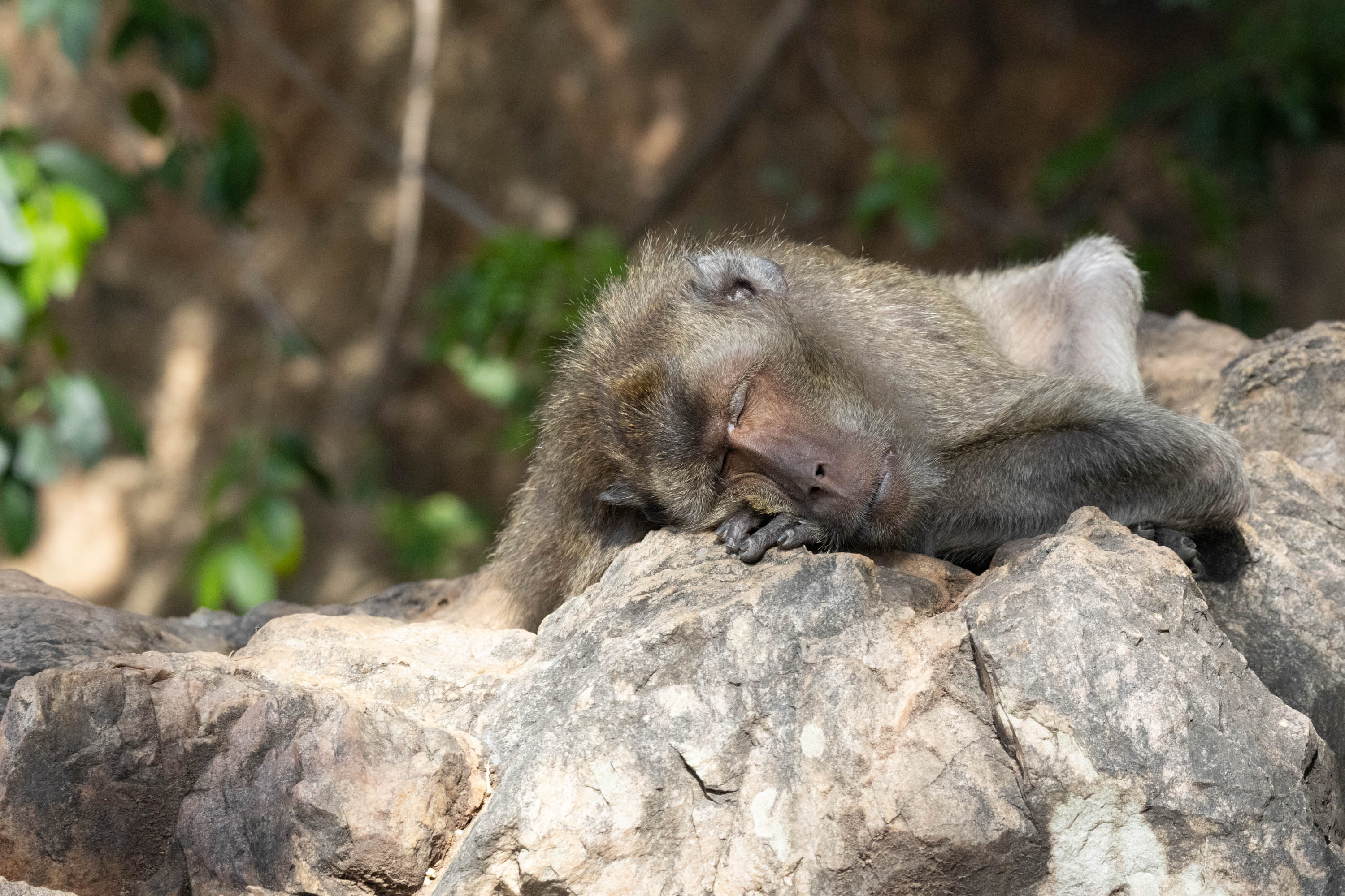
We saw a variety of monkeys, including gibbons, long tailed macaque, and dusky langur’s.
Dusky LangurLong tail macaqueGibbons
While I would have loved to see more, I guess that would be greedy, as we were very fortunate to see what we saw.
I can’t thank our guide, Pip Pip, enough for his time, patience, and inspiration for teaching us and showing us these magnificent creatures. We had such an amazing time and saw so many fantastic sights.
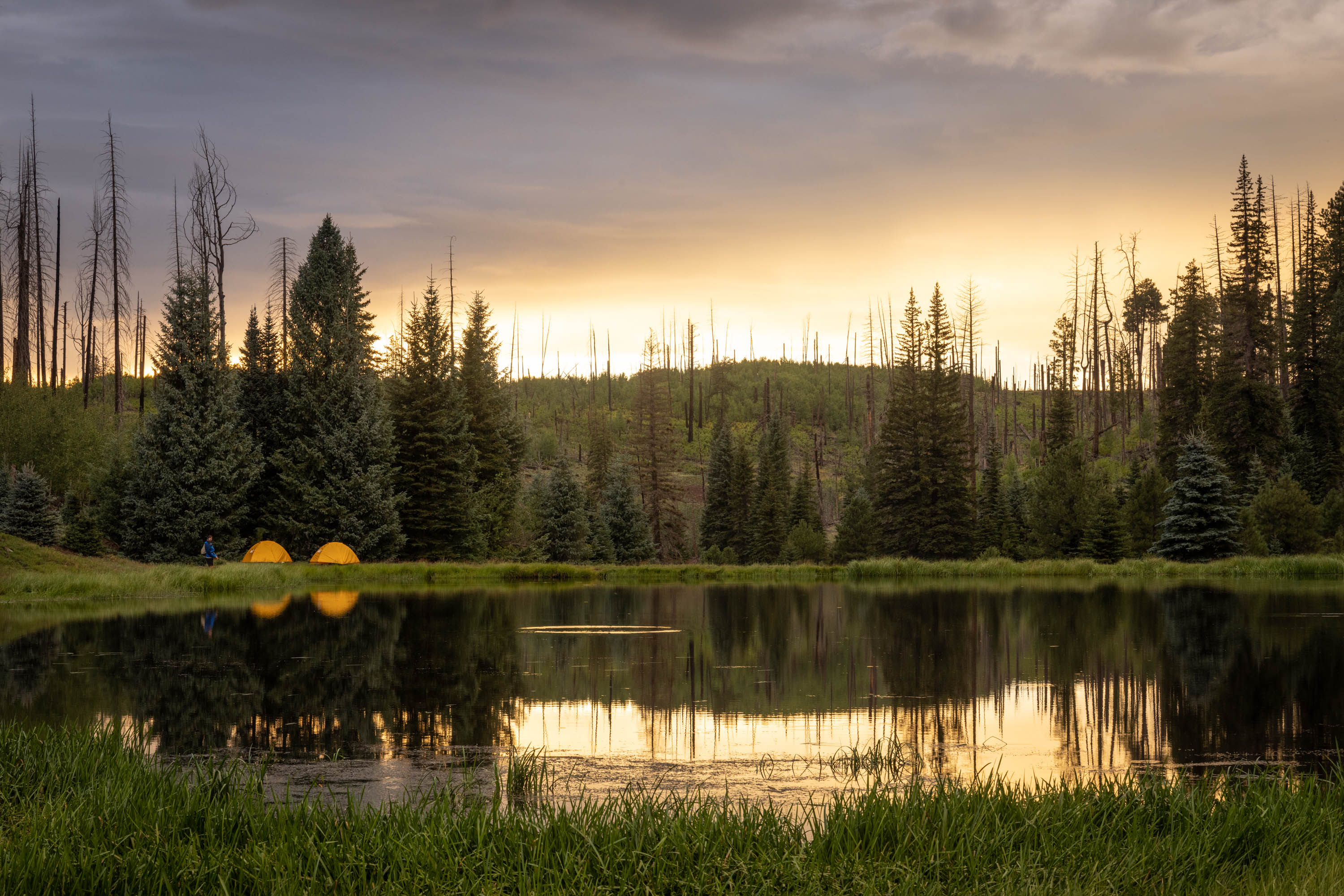
I’ve always thought Hannigan’s Meadow was a long way from anything. Probably because it essentially is. It is nearly on the border of New Mexico. It’s 275 miles from Phoenix, and 225 miles from Flagstaff.
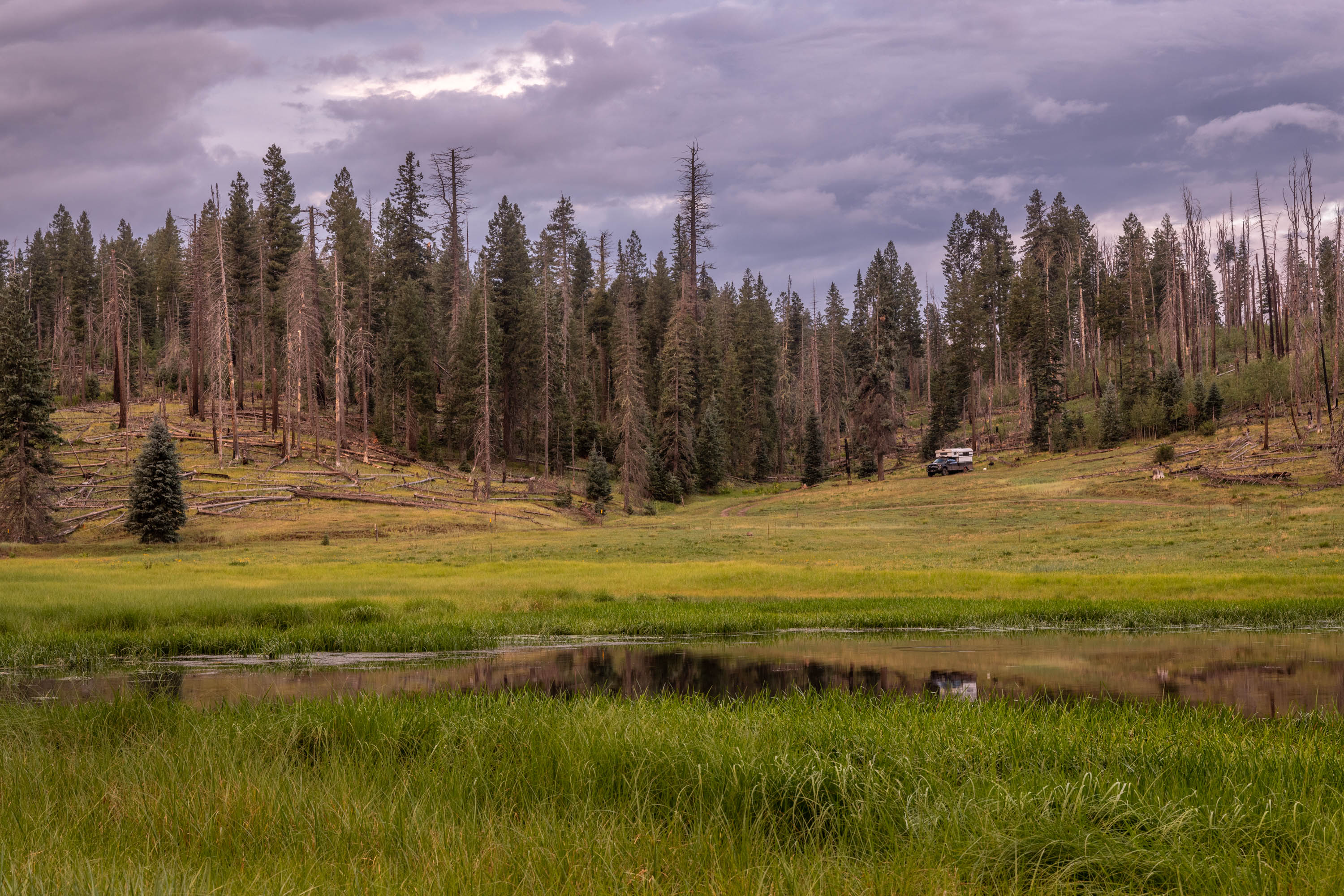
It’s seclusion though gives it that inner beauty, that long away sense of isolation and independence. It used to be a favorite get away from the big city. But the Wallow Fire some 12 years ago tore through Bear Wallow Wilderness and consumed 538,000 acres, giving it the unfortunate recipient of Arizona’s largest fire in history.
It still wears the scars of that fateful 6 weeks in 2011 that raged through Hannigan’s Meadow, Greer, Alpine and the wilderness beyond. The two cousins that started the fire were sentenced to 2 days in jail and 200 hours of community service. Further restitution hearings to cover the over $79 million cost to fight the fire resulted in a further penalty that the two individuals pay $3.7 million at monthly payments of $500 for one, $250 for the other for 4,900 years.
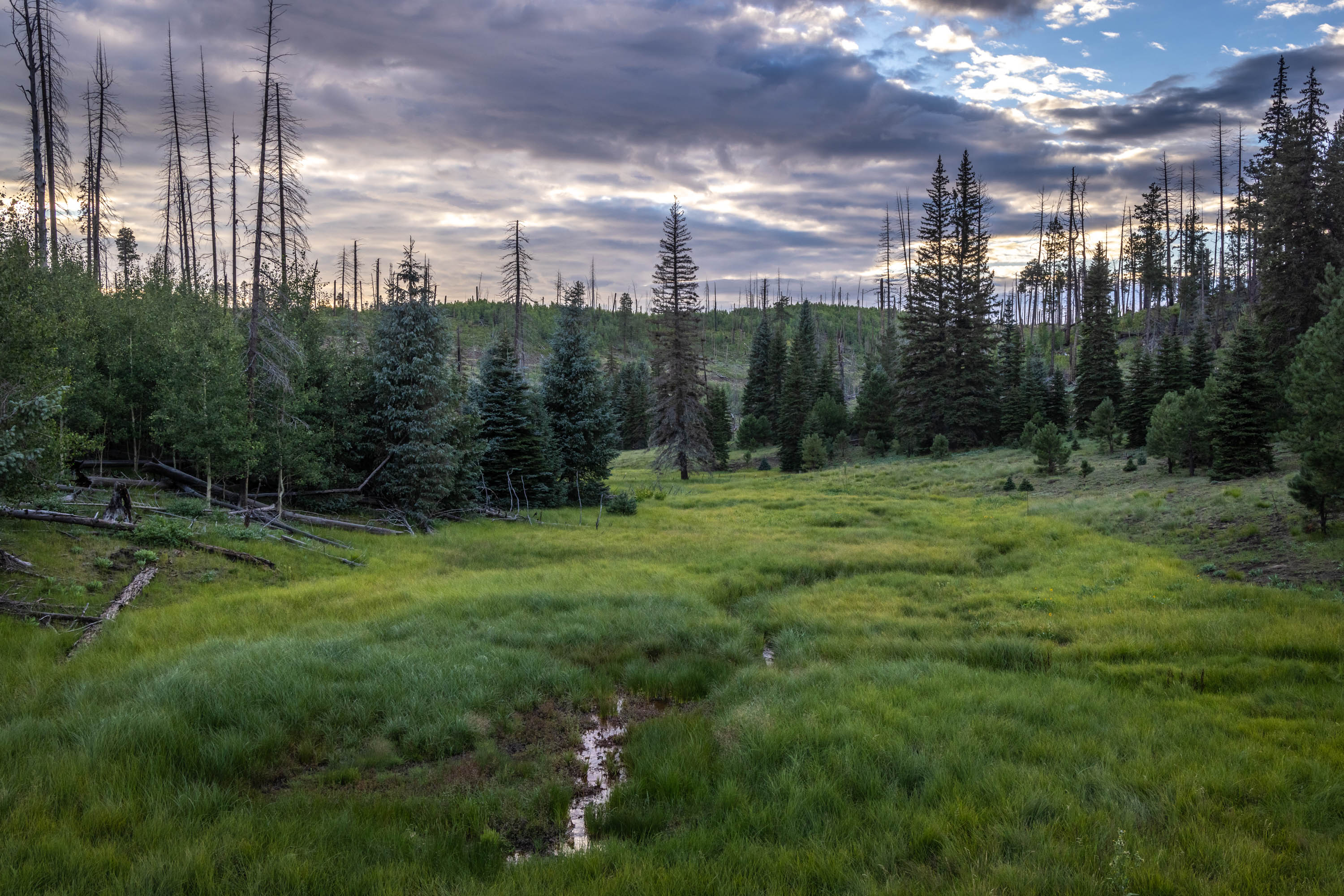
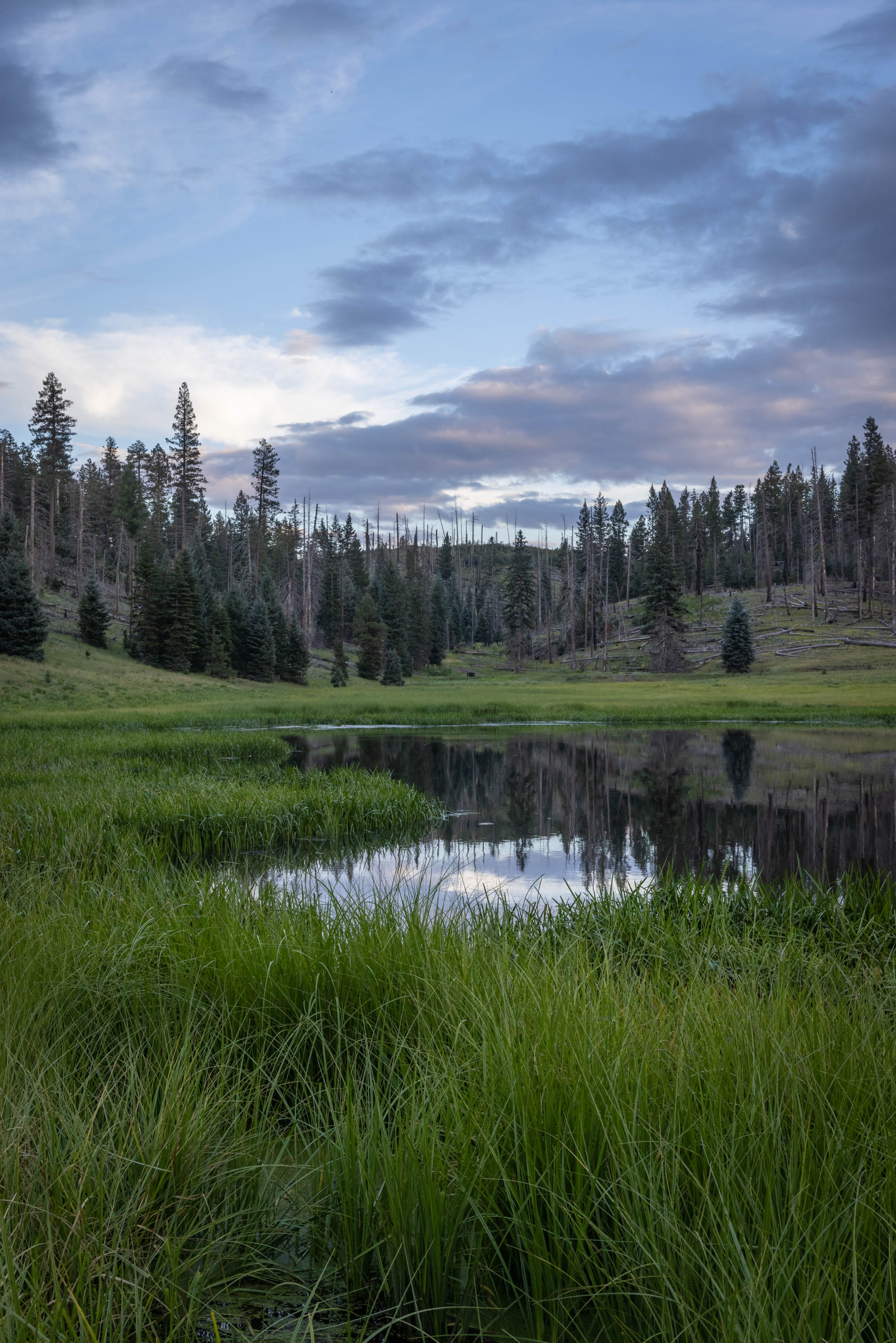
The area will never be what it once was, but new growth has re-generated new wildlife, landscape, and campers to the area. We enjoyed several days in the mix of devastation of fallen and scorched trees, and meadows of grass and small lakes.
We found it be a beautiful place, peaceful and serene. It boasts few visitors these days, which made it more attractive for us.
The dawn of a new day yields lessons from our past, and hope that we learn and grow for the future.
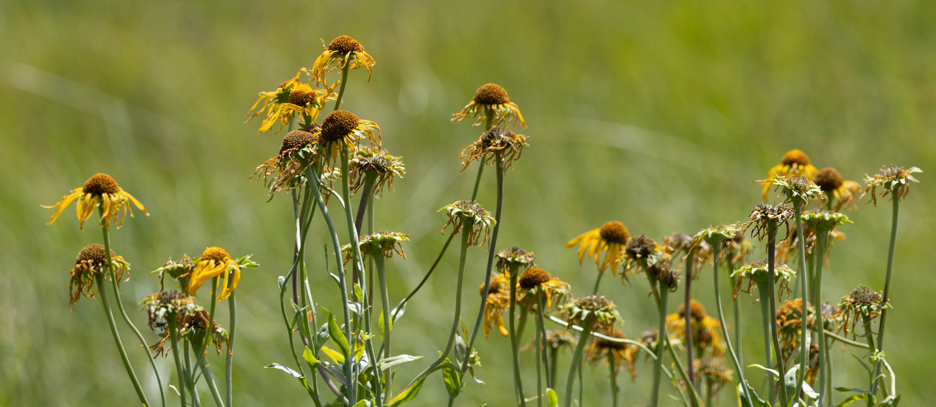
I’m not by any means a ‘plant person’. I have more of a black thumb than green. But I do enjoy the wildflowers that grow on the hills in the summer, the colorful arrays along the roadside, and the occasional wildflowers we might find in our travels.
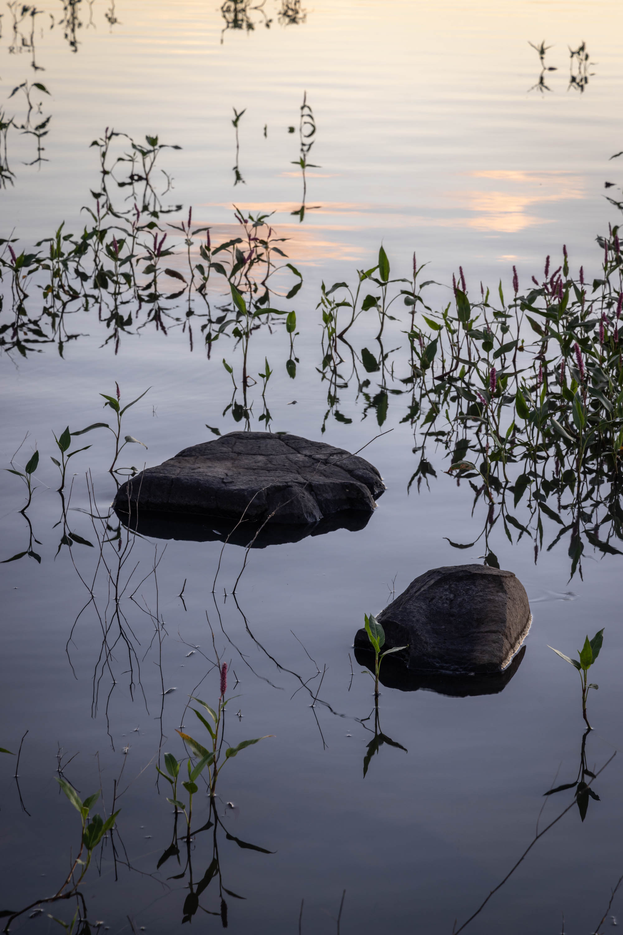
As a photographer, I have found myself learning all kinds of new things we find along the way. iNaturalist is certainly a helpful tool I carry on my phone to assist in the identification of something I am unfamiliar with, as it did for these knotgrass we found at the Lake.
Knotgrass is a perennial plant that grows in clusters that spread along the base. It is enjoyed by the small insects and birds along rocky wet soil. Knotgrass or knotweed is a type of water smartweed, which I mentioned here … https://kritterspix.com/2023/07/13/smart-weeds/. There are actually 6 species of this Persicaria plant in Arizona.
For us, it made an attractive backdrop during our day at the lake.
Summer is wrought with widespread weeds, evasive and native. I often find weeds are a matter of perspective. Webster’s Dictionary defines a weed as “a plant that is not valued where it is growing and is usually of vigorous growth”. Yet wildflowers, by their very nature, are indeed weeds. Beauty is in the eye of the beholder.
Just Northwest of Santa Barbara, CA is this little triangle of small towns, Solvang, Buellton, and Los Olivos, that are full of charm, character, and scenic opportunities. Solvang offers Danish charm where one can feel like they were transported to Copenhagen and gorge themselves on butter cookies and ebelskivers. The city was founded in 1911 by Danish settlers and includes a Hans Christian Anderson museum and park. Buellton is considered the Home of Pea Soup, where Pea Soup Andersen’s has been serving scratch made fresh pea soup since 1924. Los Olivos has multiple wineries, tasting rooms, restaurants and eclectic shops.
The Central Coast of California is well situated North of the Los Angeles / San Fernando Valley and South of San Francisco / Paso Robles area. The area is littered with agriculture and small farm stands selling local produce. The landscape is dotted with craggy oak trees that can reach up to 600 years old, and are native to the area.
We wandered around, ate & drank, visited wineries, and poked around the numerous shops. It’s the stuff vacations are made of, relaxing and indulging in the local culture. We drove some of the back roads around Foxen Canyon. We wanted to drive through Figueroa Mountain, but the historic snow and winds in the area closed the areas to traffic.
Further Northwest is Cambria, another charming town worth exploring along the coast. Just outside of San Luis Obispo, Cambria is a popular destination spot for locals and tourists alike.
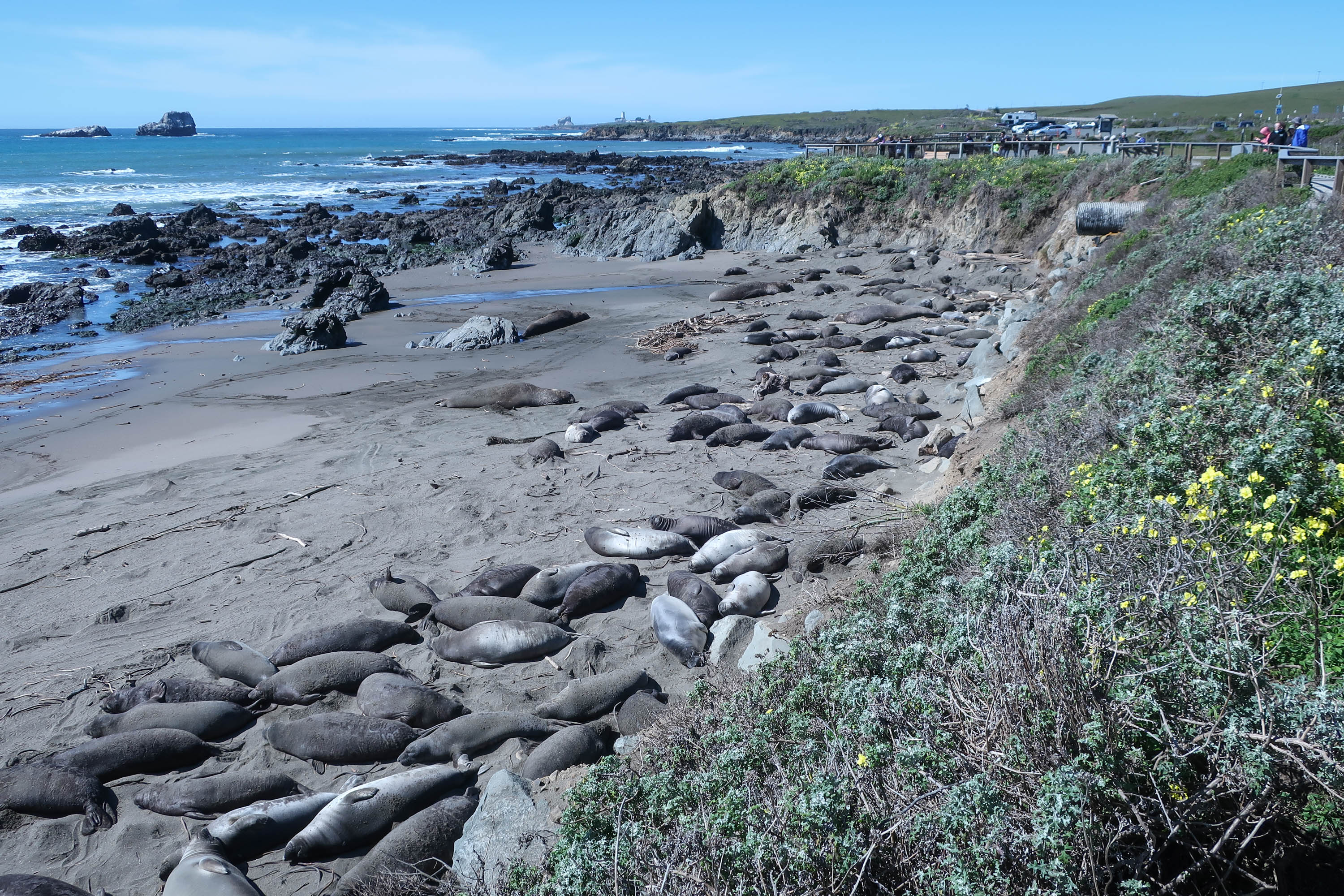
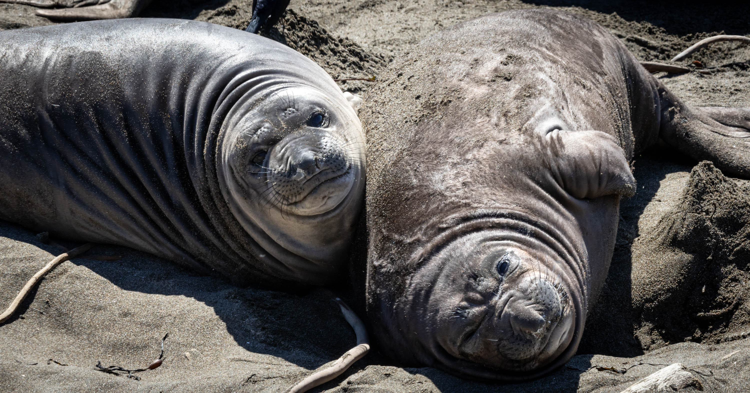
Cambria is a convenient location close to Paso Robles, 30 miles North, Hearst Castle (San Simeon), and Elephant Seal Vista Point.
While in Cambria we enjoyed a gorgeous hike along Fisculini Ranch Bluff trail (at the end of Windsor Rd) with great trails along the oceanside. We indulged in our own picnic at one of the many ‘twig’ benches along the well kept paths.
Next time we are in the area, Cambria is well worth a stay. Another hike we would have loved to do was the Moonstone Beach Drive at Leffingwell Landing.
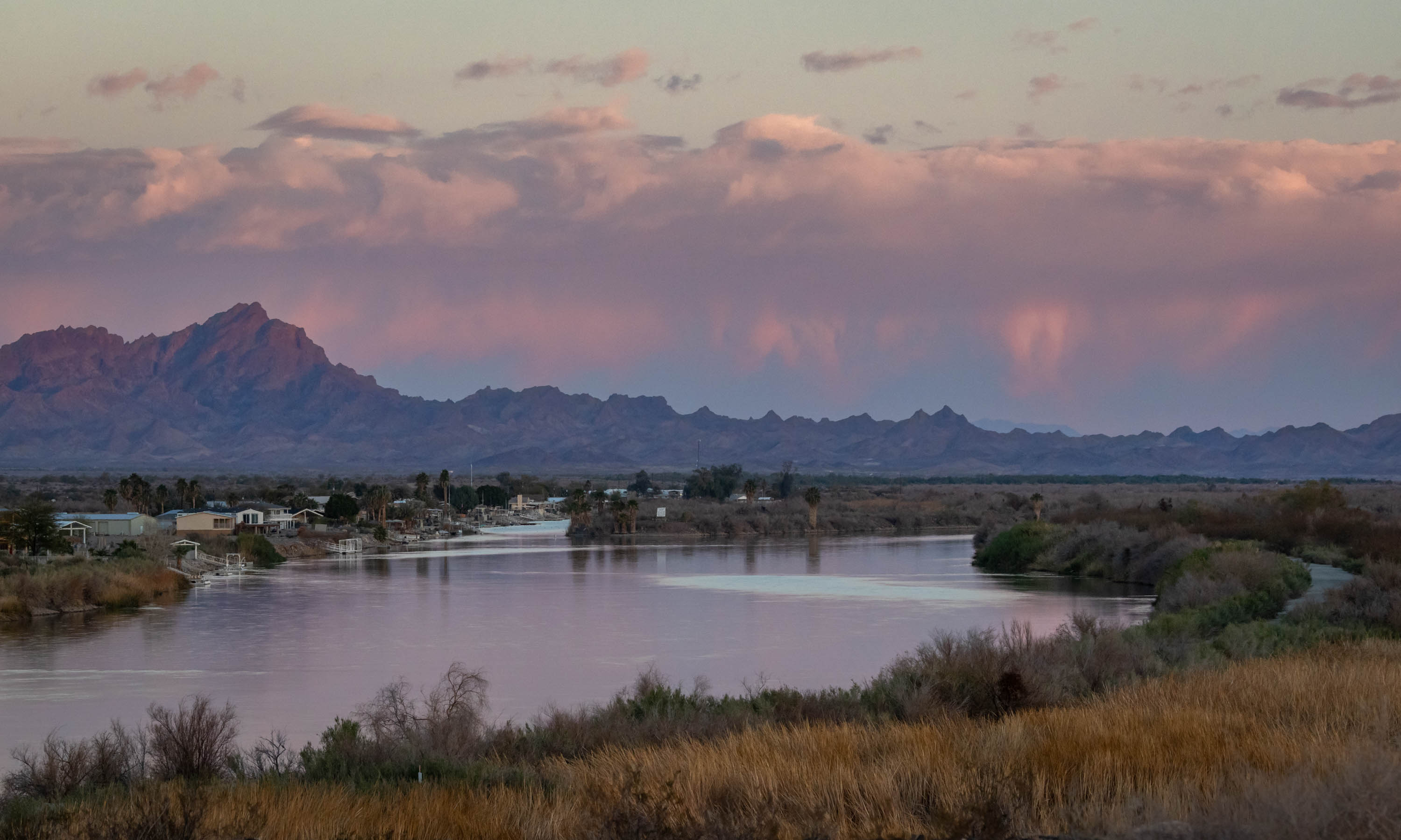
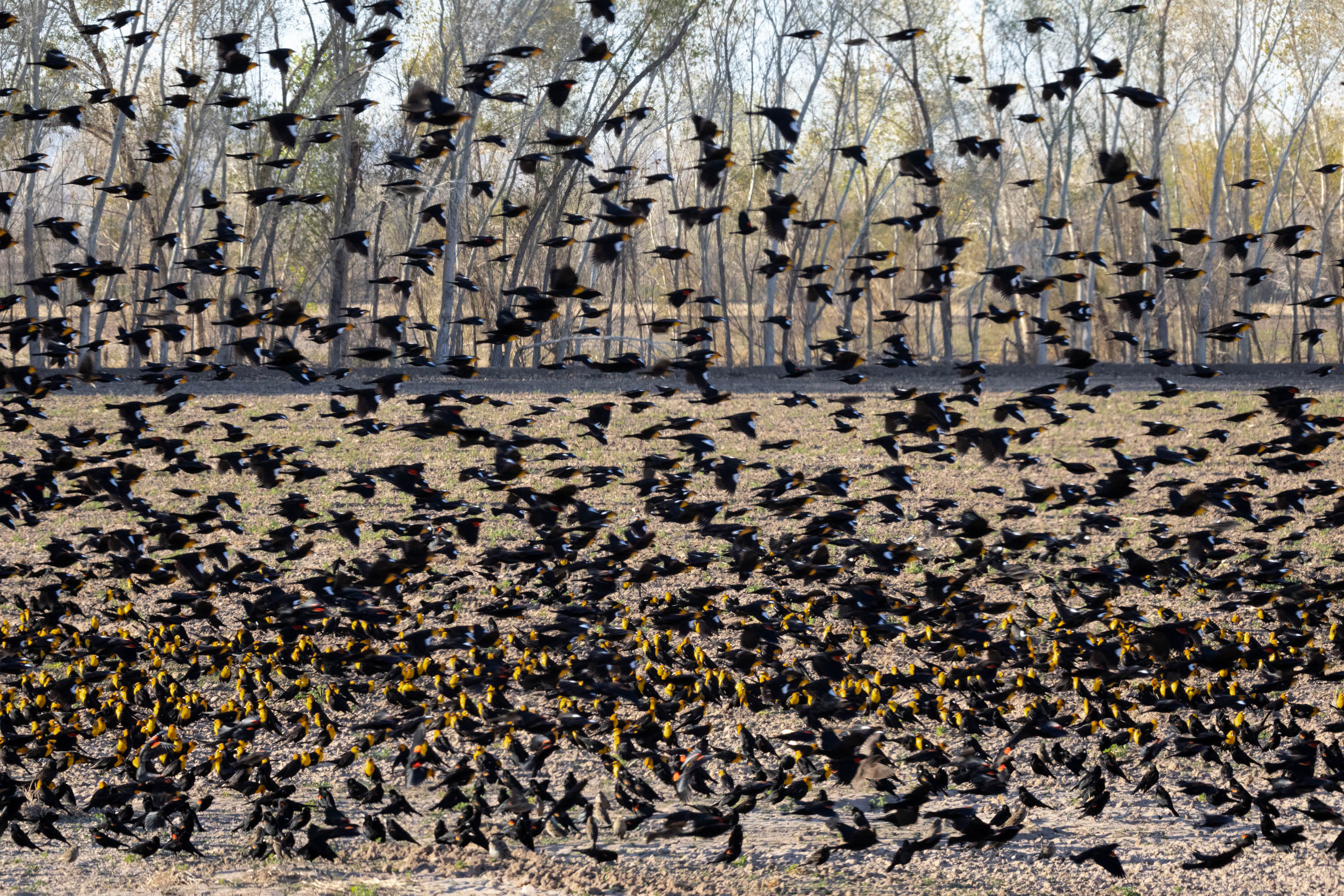
Cibola Wildlife Refuge was established in 1964 to channel the Colorado River to prevent flooding. This 18,000+ acre refuge created marshes and backwaters that have become wintering grounds for migratory waterfowl. It lies in the southwestern part of Arizona, just North of Yuma.
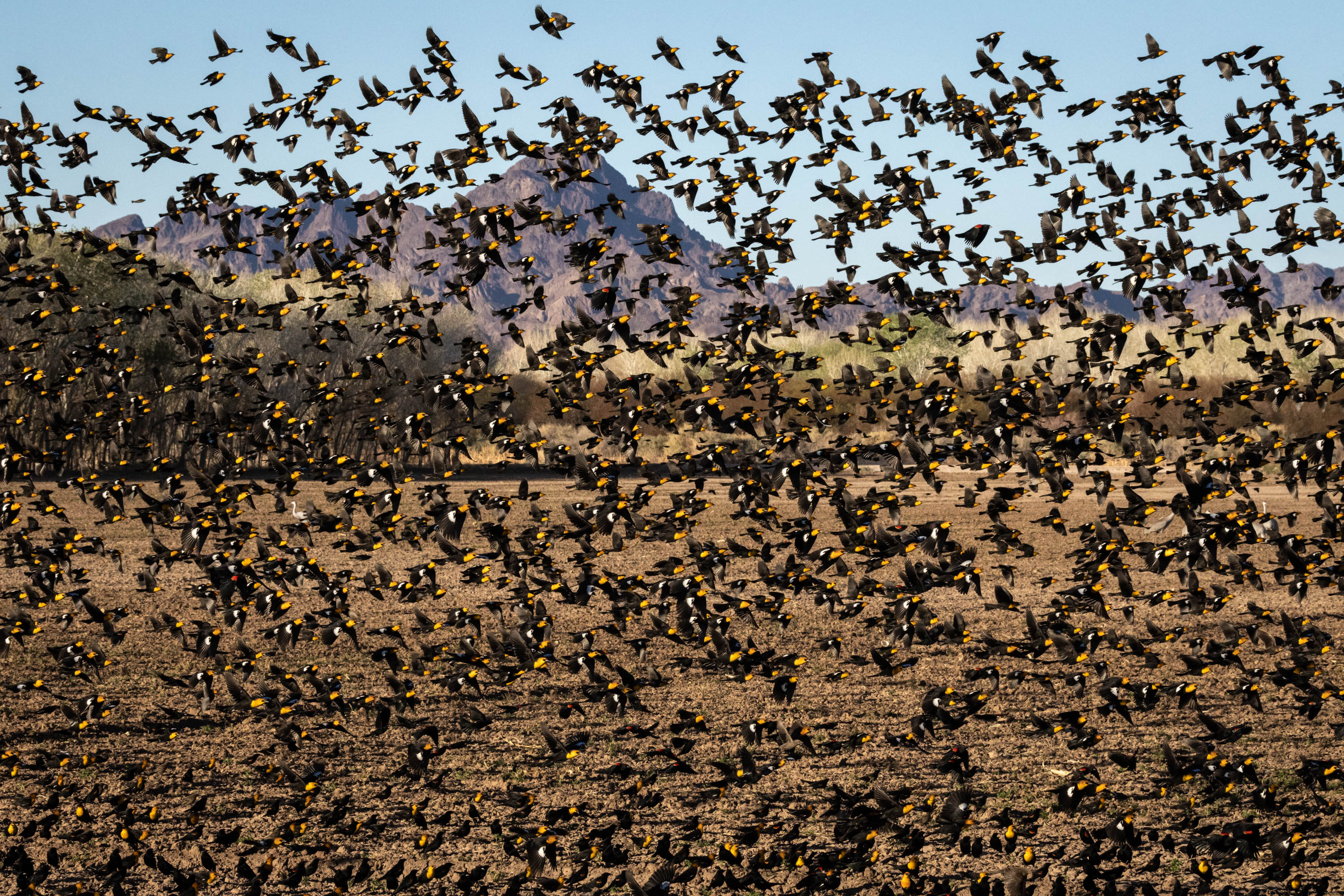
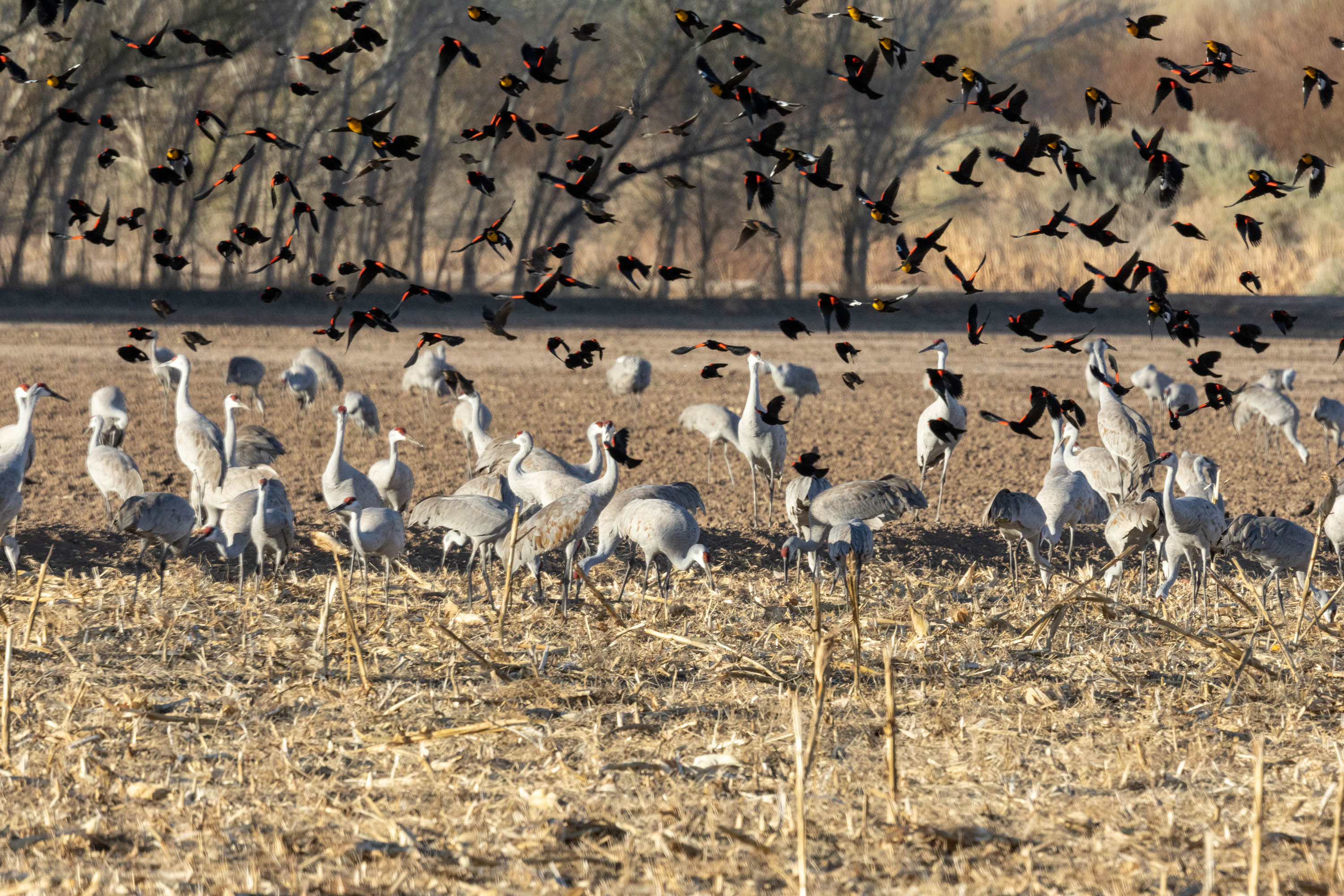
When we were there they had ‘drained the swamp’, if you will, or the marshes to be more specific for maintenance. As a result, there were very few sandhill cranes. The stunning number of red winged and yellow headed blackbirds more than made up for it though. It seems where the cranes weren’t the blackbirds had the corn field to themselves and were there is hoards.
They were mesmerizing to watch as they swarmed between corn fields, filling the air with red, black, and gold.
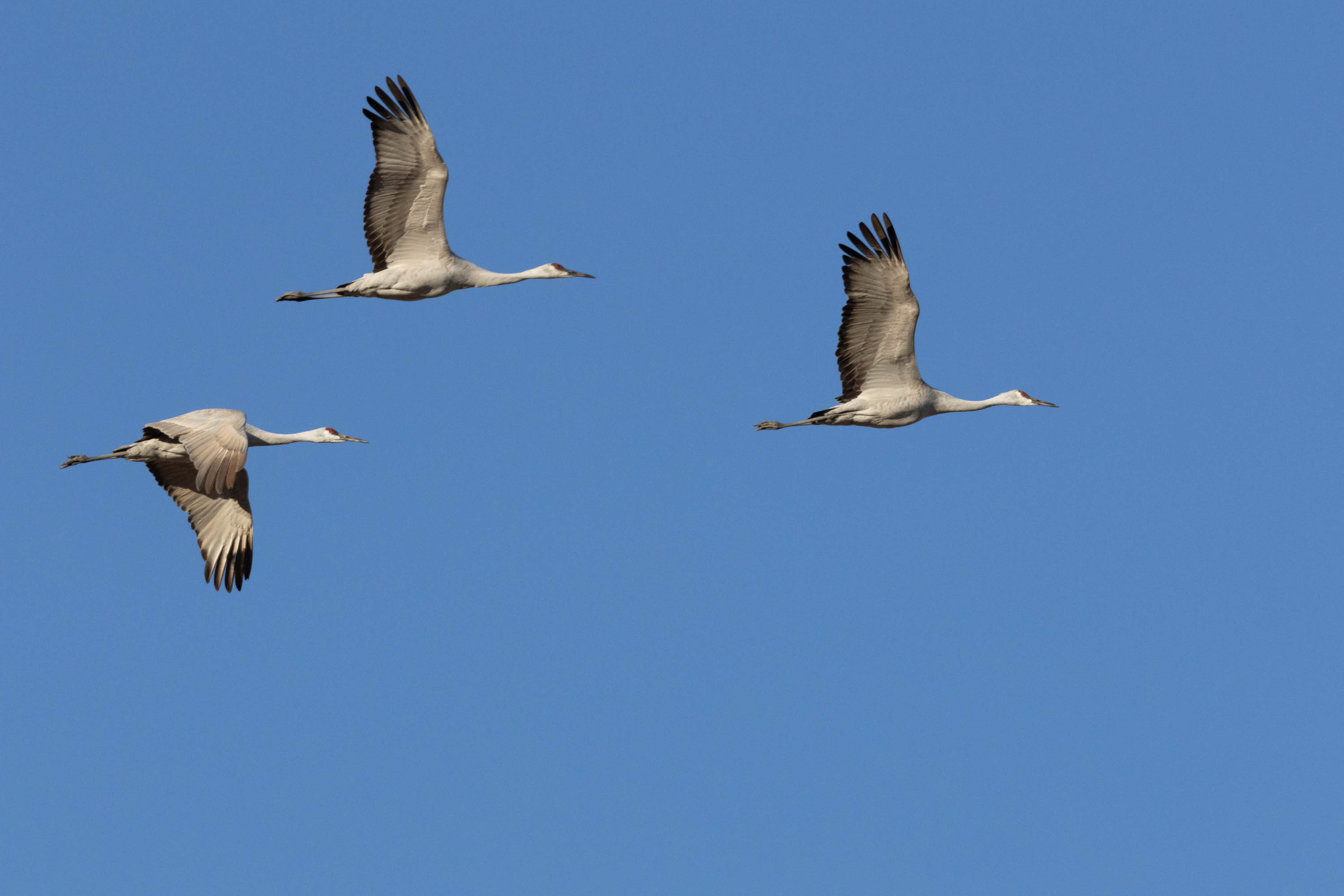
It truly was a sight to see. Besides blackbirds we watched teals, hawk, and a few sandhill crane.
If we were to go back, it would be worth dragging a boat to see what might lurk in the grasses along Cibola Lake, which opens March 15. We had thought we could launch from the Oxbow Campground, but with all the maintenance taking place, the ramps were steep and difficult to use. Next time.
We recently checked out Whitewater Draw south of Tucson and just outside of Willcox, AZ to see the massive sandhill crane migration. You can see my post here… https://kritterspaw.com/2023/01/28/natures-wonder/. We figured while we were in the area we could check out Chiricahua National Monument as it is not far from Whitewater Draw.
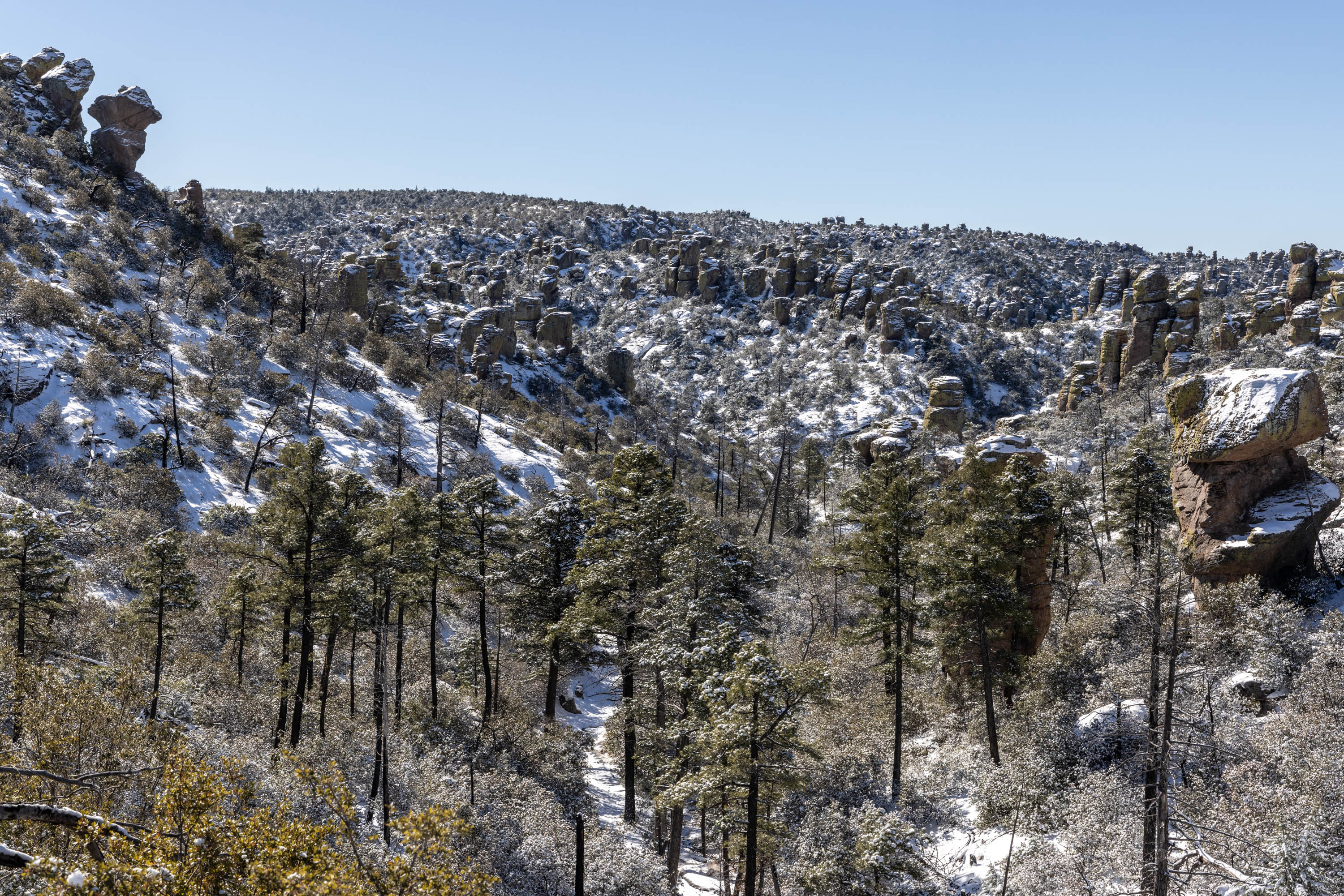
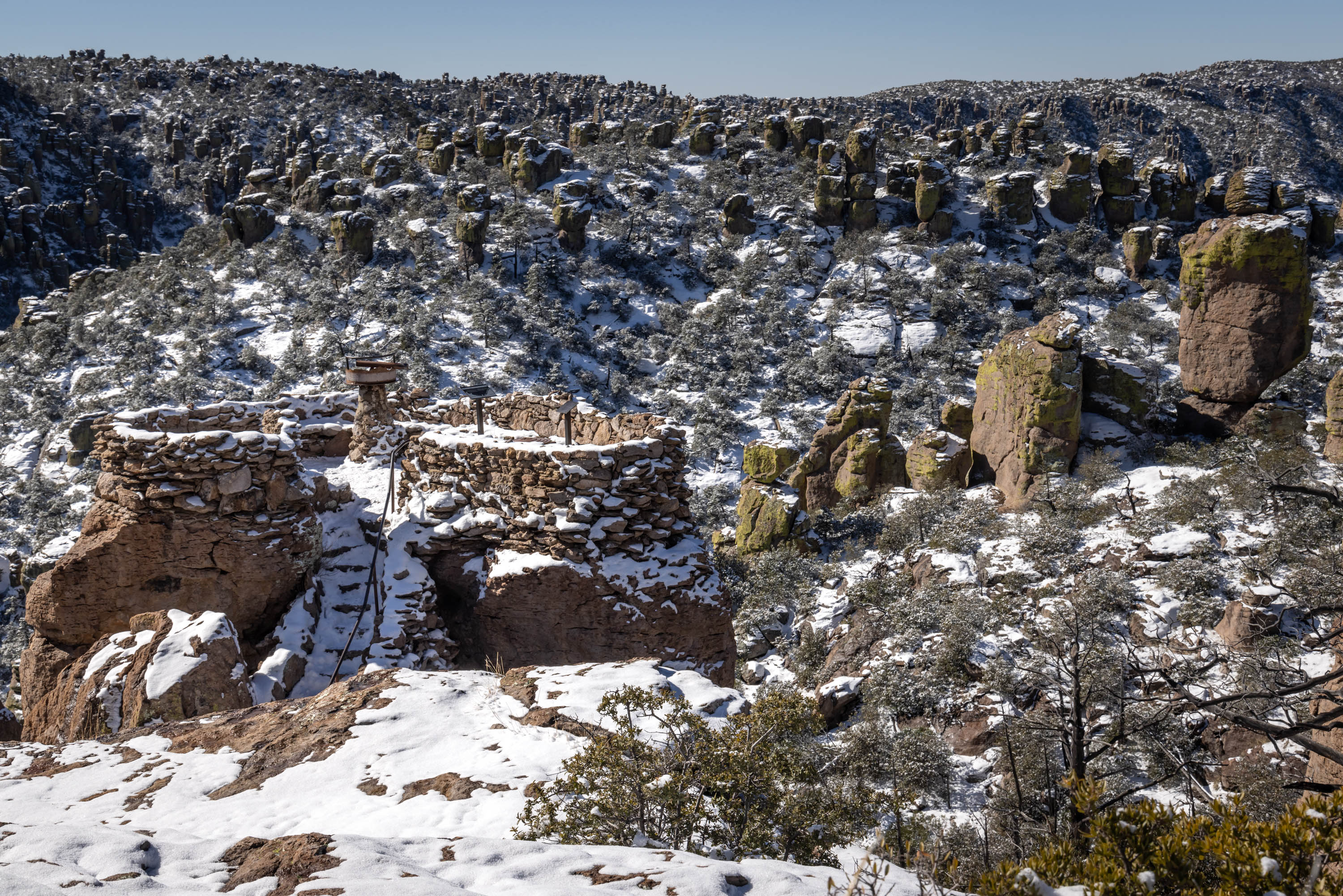
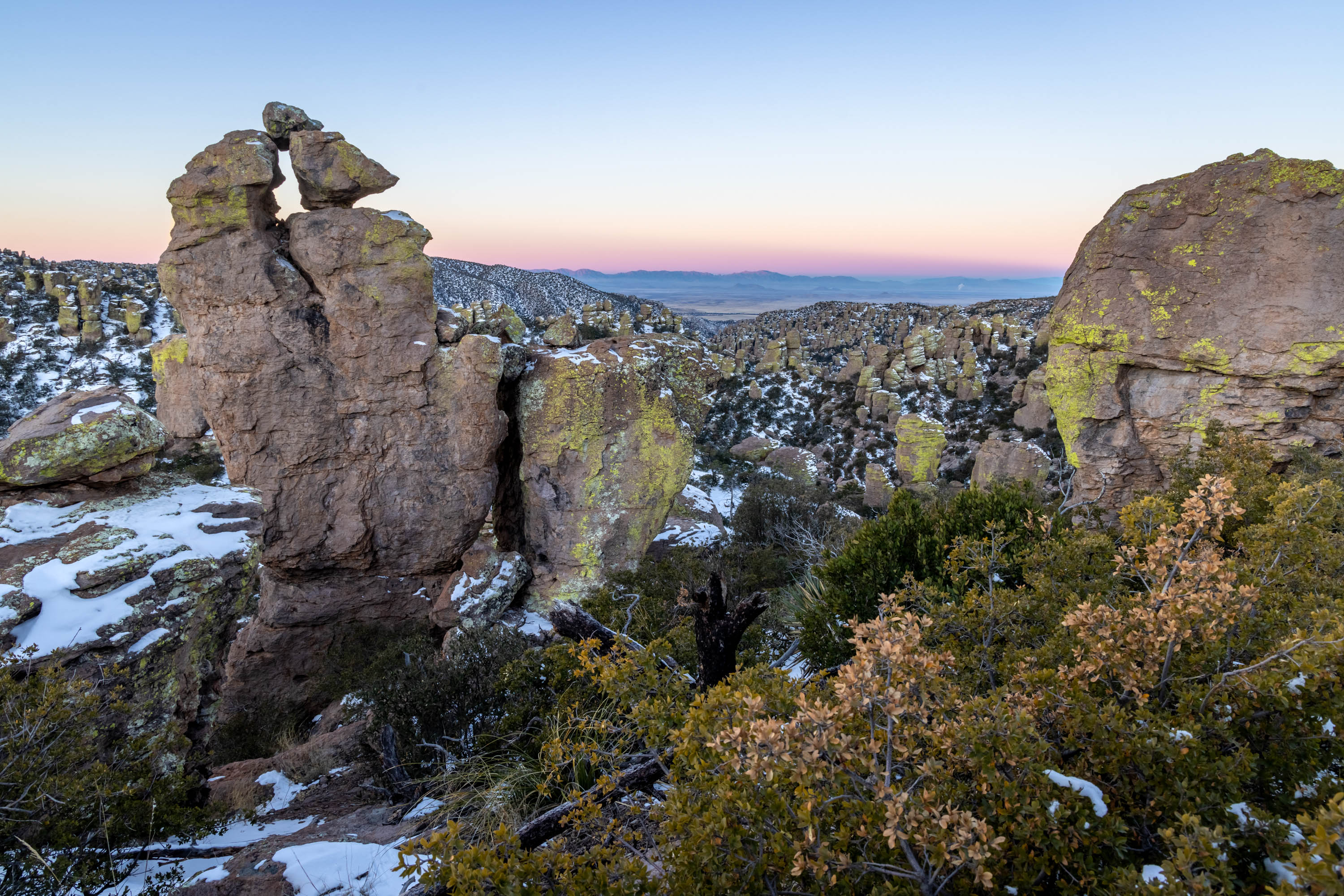
Chiricahua was established as a National Monument in 1924 to protect the over 12,000 acres of ‘pinnacles’ that jut from the ground. It’s said that these pinnacles were formed by a volcanic eruption from Turkey Creek Volcano over 27 million years ago. The volcano spewed ash over 1200 square miles cascading into fields of tall spires forming layers of gray rock called rhyolite.
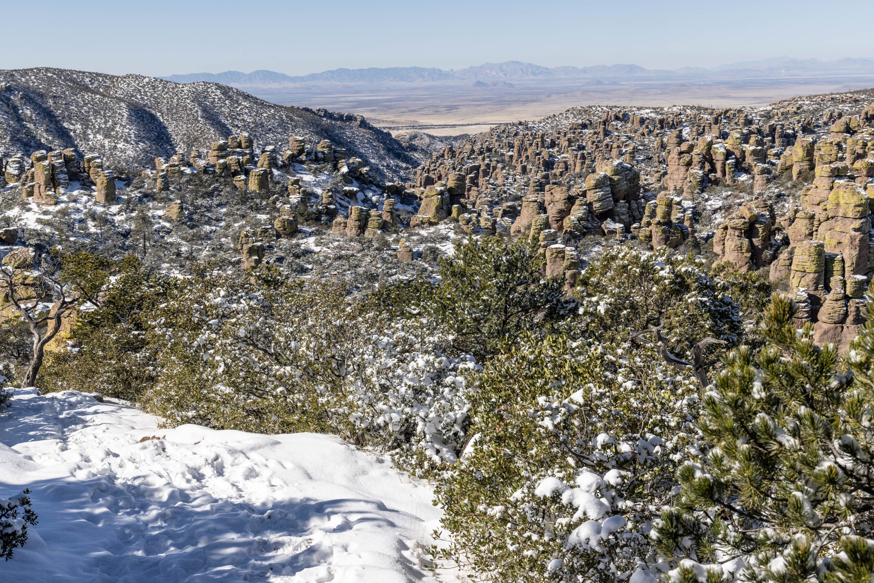
This isolated mountain range rises above the surrounding grassland sea as if you are climbing into a sky island. Meadows dot the landscape with scattered cactus, mesquite, sycamore, juniper, and oak trees. The remarkable spires signify the unmistakable guardians looming from the forest floor that is Chiricahua National Monument.
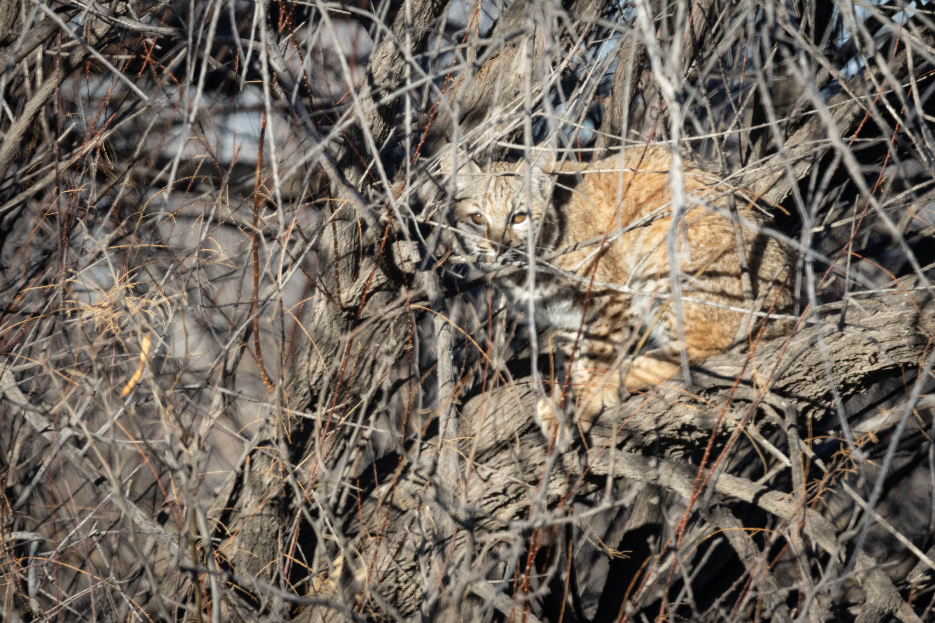
The area is rich with hawks, deer, and even bobcat.
The park itself rises up to 9,763 feet and when we were there we found the trails to be solid ice and snow. The pinnacles still wore patches of snow from a snowstorm earlier in the week. The cold temperatures (24F when we were there) ensured the snow lingered for our morning sunrise.
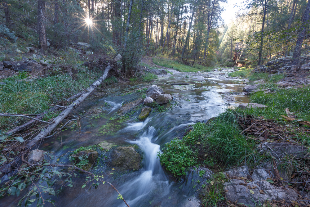
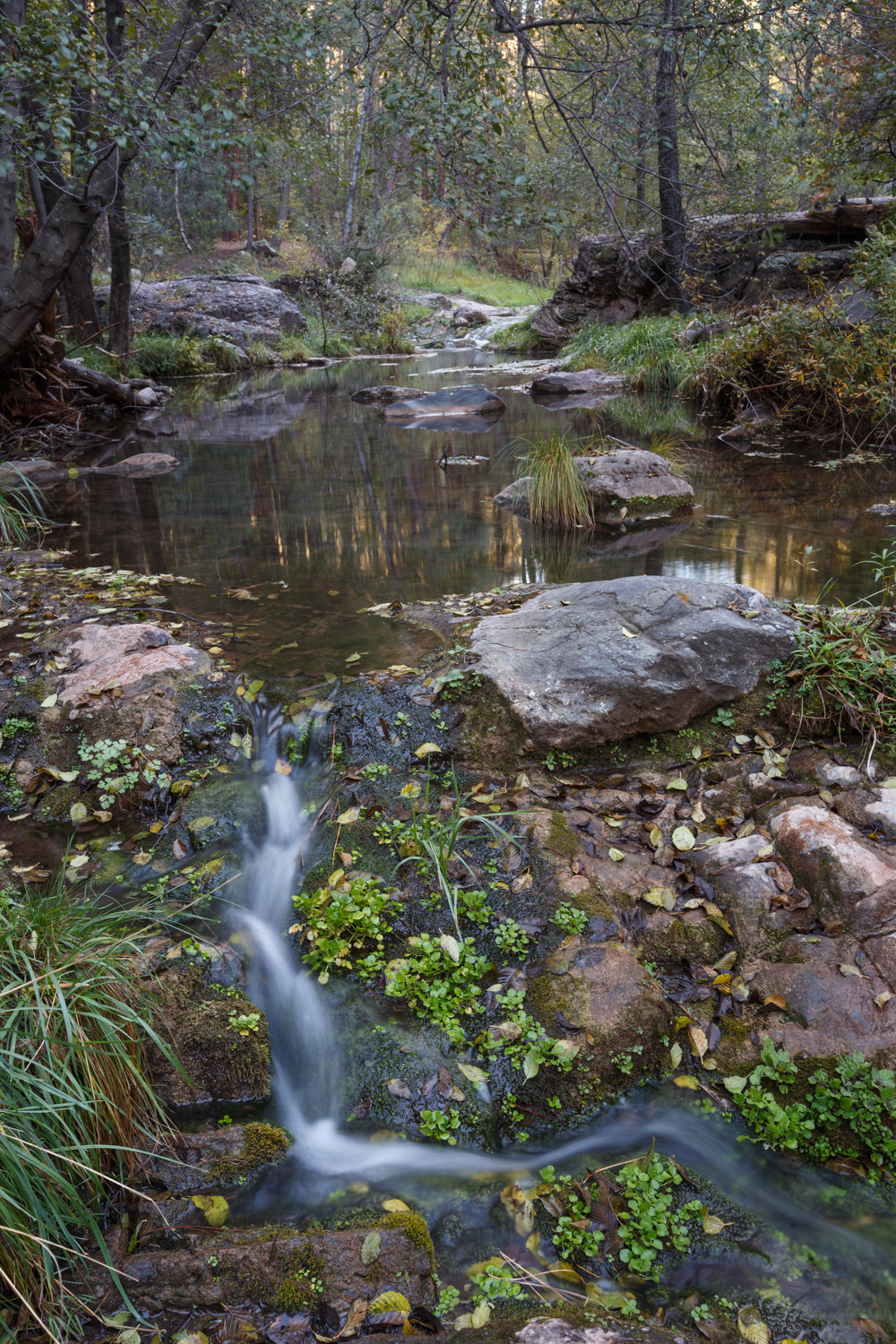
When fall has fallen… see my post here https://kritterspaw.com/2022/10/15/fall-has-fallen-2/ it’s time to head south to lower elevation. Mogollon Rim is about 7600′, so we headed outside of Payson to Haigler Creek at about 5500′ to see if fall colors were starting there.
We were pleased to find some dappled color along the shores of Haigler Creek surrounding the cascading stream.
This has become a new favorite spot with its gorgeous scenery and peaceful babbling brook. While it is difficult to get to, certainly not for the 2×2 car, it is worth the effort.
I love the water gushing through the rocks and spilling downstream through twists and turns over fallen trees, branches, rocks, and brush that divert it’s flow. It is so free and unencumbered. It reminds me of a quote I am fond of, “Time is like a river. You cannot touch the same water twice, because the flow that has passed will never pass again. Enjoy every moment of your life”. It’s peaceful machinations are a good reminder of what’s important.
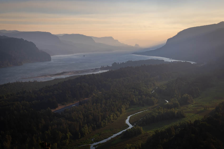
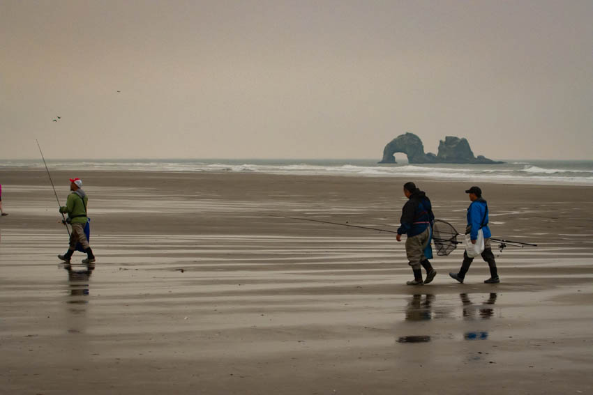
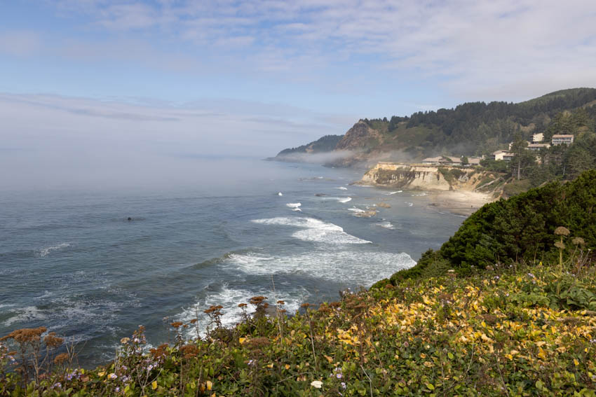
Coming from Arizona, Oregon is a whole new experience. While we are used to canyons and ridges, cactus and creeks, deer and elk, scenery loaded with oceans, pelicans, otters, and redwoods is foreign land.
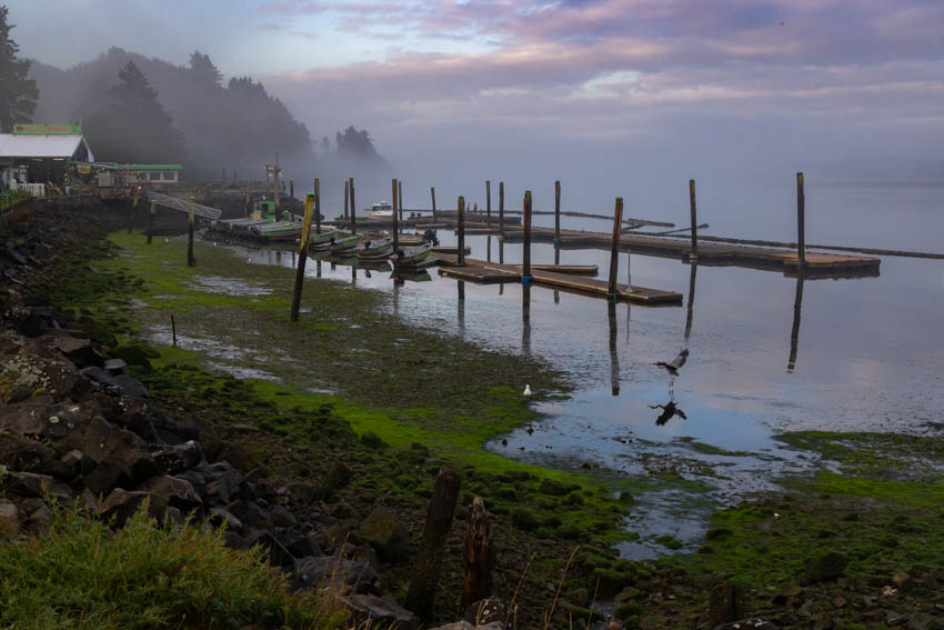
We drove north to Astoria, then slowly worked our way down the coast, camping along the way. We stopped and picked up fresh caught fish from the docks caught that morning, fresh veg at local farmers markets, and bread, cheese, and condiments from charming artisan stores and bakeries.
The scenery was stunning throughout, though we got our fair share of fog and overcast days. Walking on the quiet beaches in the mornings was peaceful and relaxing. Though, I must confess the damp weather was something we weren’t used to from our dry-heat of Arizona. Everything we owned was damp, wet, and difficult to dry.
We stopped at a number of Oregon State Parks, each having its own allure. Some had beach access, while others had tons of trails. Several had campgrounds, many were day use only. It was stunning to see how many State Parks there were. There had to be almost 50 parks just along the coast.
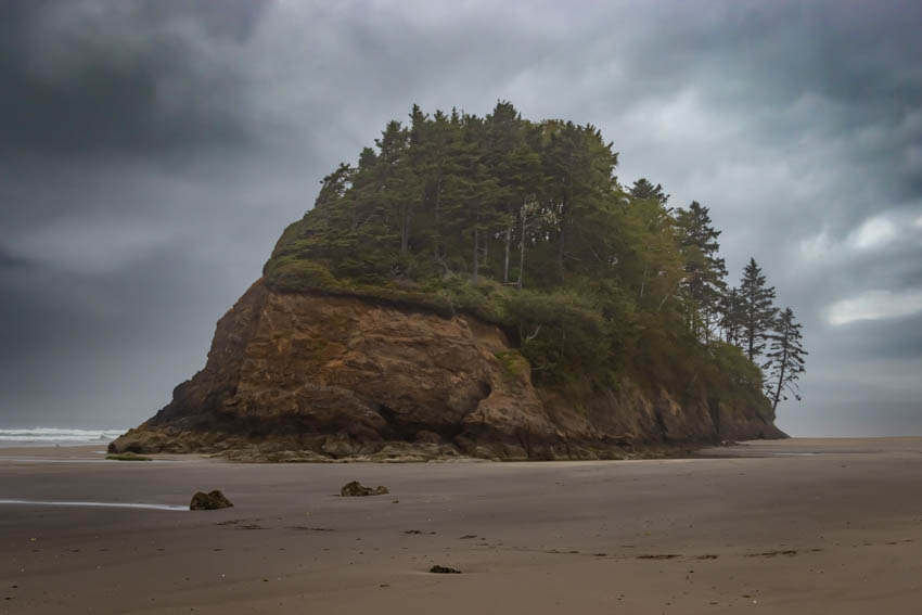
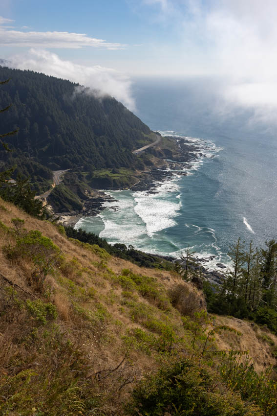
The coastline was gorgeous as we traversed our way down coast. Around every corner was a new sight to see; a new place to stop; a new picture to take. We planned to go 50 – 60 miles / day. Normally that would take an hour, under city highway (no traffic) standards. Every once in awhile we would push to 140 miles give or take / day. We ‘d leave early in the morning to catch sunrise, and wouldn’t get to our next stop until late in the day. We never stayed any place just one day – always at least 2, up to 4 days.
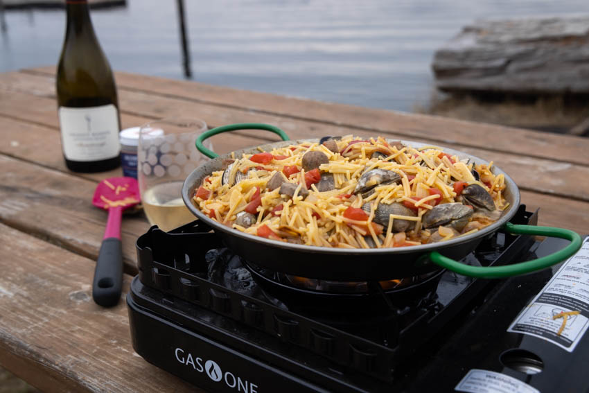
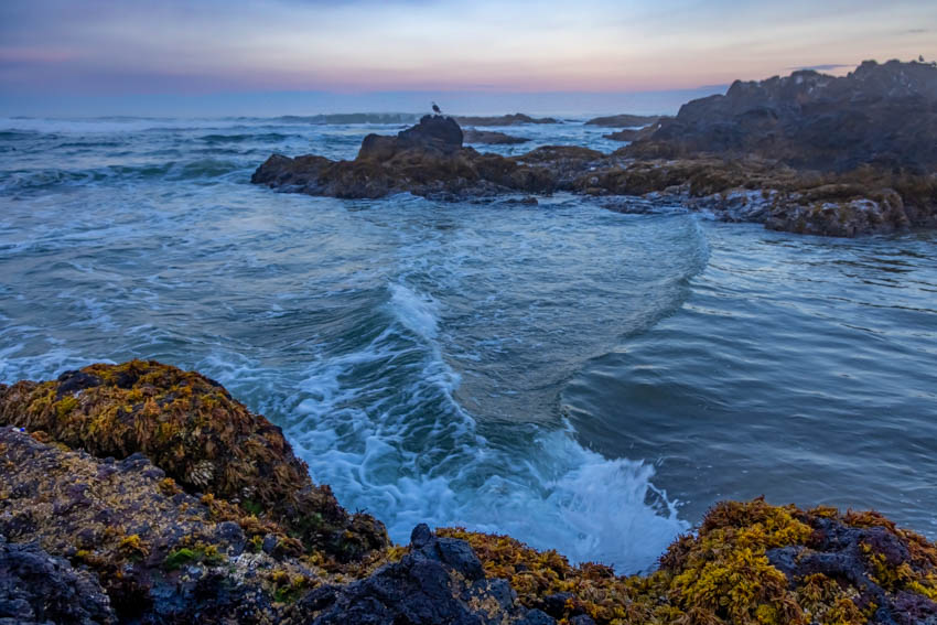
We stopped for lighthouses, beaches, and markets. We stopped for overlooks, pull-outs, and food stuff. We’d relax in our camp at night and enjoy preparing great meals with our fresh goodies.
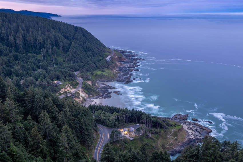
Our last stop along the coast was Bandon. We found Bandon to be particularly charming with its many rock formations and spectacular coastline. Fish & chips (and a tasty selection of grilled fish options, oysters, shrimp, clams, and chowder) could be had right on the water overlooking the boats, or fresh fish and shellfish picked up from several local choices. There were several restaurant choices in town, and even a fromager (cheesemaker), Face Rock Creamery. There is even a distillery, a cider mill, and nearby wineries (though not in Bandon).
It was an extremely pleasant trip along the coast full of tasty treats and sights. Maybe next time we will venture inland… or maybe not.
With our monsoons brewing, this is a great time of the year to capture awesome clouds and weather.
So we headed out to the Rim to see if we could capture some interesting photos. While we were actually thinking we would get fog after the previous day’s rain. We were just greeted with more rain, and a few elk.
We always consider it a gift whatever we might get. No matter what, it’s always a good day out and beautiful trek through the forest.